
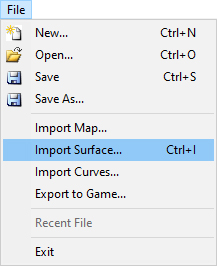
To import terrain or update part of the terrain in the map, use Import Surface command.
You have the following possibilities to launch Import Surface command:
- From File drop-down menu select Import Surface
- Using the keyboard shortcut: Ctrl+I
How to do it:
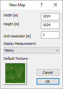
In the up menu File / New I’ll create a new map with approximately the same size as the terrain which I want to import. Map is made from blocks in size 64x64m, so created terrain must be multiple of number 64. Otherwise will be the size of the terrain rounded to this number.
The most use size of terrain is 1024x1024m, 2048x2048m, 4096x4096m (the maximal size of the map).
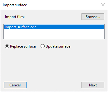
I’ll save the satellite image for this terrain (with the same position and size as the terrain) into the folder where I have .xyz terrain data. The name of this image will be preview.jpg
In the up menu File / Import Surface I’ll choose .xyz terrain file. In Import Surface dialog I’ll choose the file and option Replace surface.
Press the Next button to continue.
Import terrain can take a while depends on density of imported net of terrain.
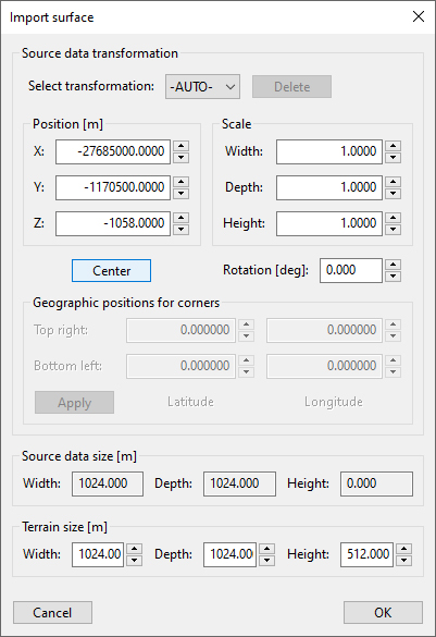
After loading of terrain we have another Import Surface dialog with information about the terrain.
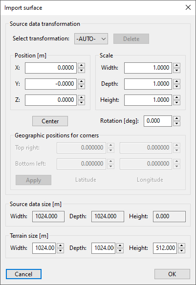
I don’t see terrain so I’ll click on Center button. Terrain will be centered on the created map.
Now I can see a red frame which means the border of imported terrain. Because the name of satellite image is preview.jpg, now I can see it with 50% opacity in the same place and area like terrain.
Press the OK button to continue.
Now I can see the window Save transformation where I can save my settings by writing the name of these settings. If I’ll not use any name, I can continue without saving of settings.
Press the OK button to continue.
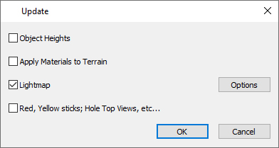
Terrain was successfully imported into the map. In the up menu I’ll choose Map / Update Map and I’ll let marked only option Lightmap.
Press the OK button to continue. Shadows will be applied on imported terrain.
In the up menu I’ll choose Map / Satellite Image. By clicking on Load I’ll choose my satellite image preview.jpg (or other with the same area and size).
I’ll set the same size like was on terrain (Width and Height). In case of nonstandard size I can change position of satellite image by set Coord X and Coord Y.
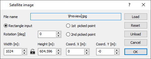
Press the OK button to continue.
I can compare terrain with shadows and satellite image by use TAB key. The most strong points for orientation are roads, lakes, rivers and sand bunkers. By compare of these positions I can see if satellite image is on right position.