
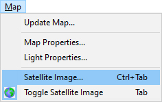
To assign and locate satellite image to the terrain, use Satellite Image command.
You have following possibilities to launch Satellite Image command:
- From Map drop down menu select Satellite Image
- Using keyboard shortcut: Ctrl+Tab
Note:
Editor supports two ways or terrain texturing:
- Satellite Image: one image drawn on the terrain with the map of terrain (obtained mostly from internet)
- Textured terrain: all materials are textured using materials from editor library
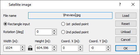
Use Load button to load the image to the map
Use Unload button to remove the image from the map
Change the Coord. X [m], Coord. Y [m] to move image over the terrain.
Change the Width [m] and Height [m] values to zoom the image over the terrain.
Use Reset button to reset the Coord. X [m], Coord. Y [m], Width [m] and Height [m] values to default values.